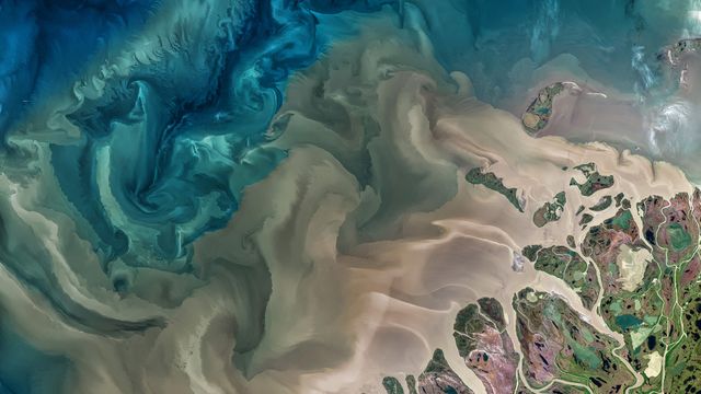
Mackenzie River, Canada, and Beaufort Sea
© Norman Kuring, GSFC/NASA/USGS Landsa
Info. The Mackenzie River in Canada emptying into the Beaufort Sea
Today’s photo, taken by NASA’s Landsat 8 satellite, shows part of the Mackenzie River delta and the river’s turbid waters as they flow from the far north of Canada and Alaska into the Beaufort Sea in the Arctic Ocean. The Mackenzie River – the longest river in Canada – plays a vital role in the Arctic climate as warmer fresh water mixes with colder seawater.
About 7% of the fresh water that flows into the Arctic Ocean each year comes out the Mackenzie and its delta, and much of that arrives in large pulses after periods of inland ice and snow melts. These pulses, known as freshets, carry huge amounts of sediment – lots of it coming from erosion of the Rocky Mountains upstream – which you can see pouring out of the river on our homepage.
 Mediterranean Sea, Ölüdeniz, Turkey
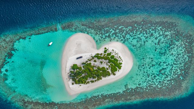 Heart-shaped island, Indian Ocean, Maldives
Bing Today Images