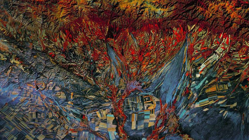
Landsat 8 satellite’s infrared photo of fields in Kazakhstan
© NASA
Landsat 8 satellite’s infrared photo of fields in Kazakhstan
The Landsat Earth-imaging programme is jointly managed by NASA and the US Geological Survey. Its mission is to capture a continuous visual record of the Earth’s surface and it’s been doing this for longer than any similar endeavour. The first Landsat craft, known as the Earth Resources Technology Satellite, launched in 1972. Landsat 8 launched in 2013 and continues to orbit the Earth, taking photos such as this composite image of Kazakhstan’s topography. This photo combines infrared imaging with a more traditional full-spectrum photo. And because of its quilt-like appearance - as if Picasso had made quilts - this image is included in the Landsat ‘Earth as Art’ collection of photos from the satellite.
Related Images
 Beach huts in Brighton and Hove, England
 Striated heron on a Victoria water lily, Pantanal, Brazil
 A large mechanical dragon at Saint George's Day celebrations
 Andean cocks-of-the-rock, Ecuador
 Women in traditional dress at the Paro Tshechu Festival in Bhutan
 Holi celebration in Jaipur, India
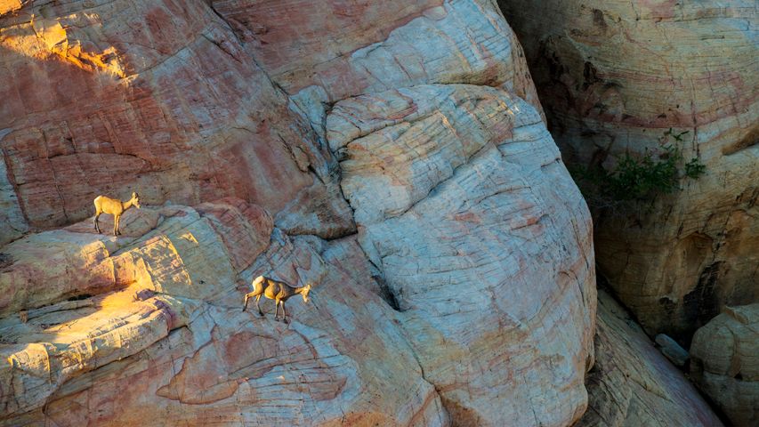 Desert bighorn sheep in Valley of Fire State Park, Nevada, United States
 Southern yellow-billed hornbills in Kruger National Park, South Africa
Today on Bing

Poinsettia or Christmas flower
Dec 12, 2024

Reed bunting, Newport Wetlands, Wales
Dec 12, 2023

Poinsettia plants
Dec 12, 2022

Wicker fields in Cañamares, Spain
Dec 12, 2021

Poinsettia leaf close-up
Dec 12, 2020