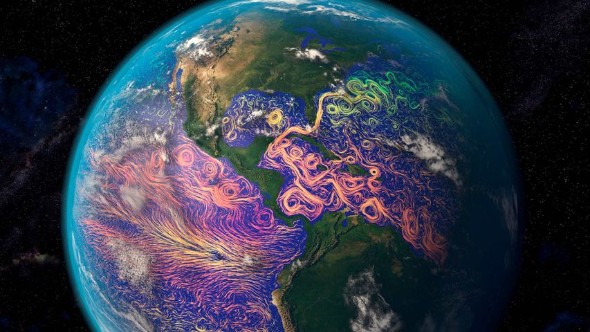
Satellite-based graphic showing ocean currents off the Americas
© Karsten Schneider/Science Photo Library
Satellite-based graphic showing ocean currents off the Americas
It’s easy to think of satellites as technology for observing the realms beyond our planet. But many satellites turn their data-gathering instruments back toward home. That’s how this ocean-currents map was created. The purple and pink swirls represent warmer ocean currents, while the blue and green are cooler currents. Maps like these aid in weather forecasting, determining the temperature of our oceans, and long-term analysis of the oceans’ health.
Related Images
 Canadian Tulip Festival in Ottawa
 Torres del Paine National Park, Patagonia, Chile
 Plumeria flowers, Hawaii, United States
 Formal Château de Villandry, Loire Valley, France
 Grove of redwoods in Redwood National and State Parks, California, United States
 Zion National Park, Utah, United States
 Kachina Bridge, Natural Bridges National Monument, Utah, United States
 Yellow warbler in Canada
Today on Bing


Hot air balloons in Cappadocia, Türkiye
Jun 09, 2023

Sweetheart Abbey, Dumfries and Galloway, Scotland
Jun 09, 2022
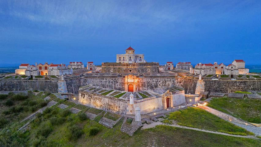
Nossa Senhora da Graça Fort near Elvas, Portugal
Jun 09, 2021

Baron Lake in the Sawtooth Wilderness in Idaho
Jun 09, 2020