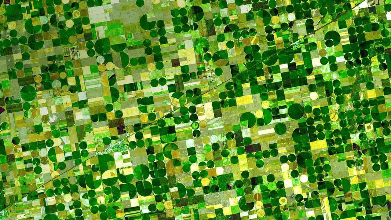
Farm plots in southwestern Kansas
© NASA/GSFC/METI/ERSDAC/JAROS, and U.S./Japan ASTER Science Team
Farm plots in southwestern Kansas
The ASTER (Advanced Spaceborne Thermal Emission and Reflection Radiometer) sensor is one of five imaging devices on NASA’s Terra satellite. ASTER captured this image of agricultural land in Finney County, Kansas, which shows corn, sorghum and wheat crops in various states of growth. Based on the time the photo was taken (June, 2001) the dark plots are probably corn, ripening faster than the lighter green sorghum fields. The gold spots are wheat, just about ready for harvest.
Related Images
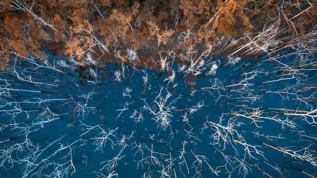 Advancetown lake and forest, Gold Coast, Queensland, Australia
 Royal Highland Fusiliers playing the bagpipes on top of the Sydney Opera House
 Memorial to the Murdered Jews of Europe in Berlin, Germany
 Alpine eucalypt bark in Tasmania
 Aerial shot of mangroves at King Sound, Western Australia
 Contemporary ballet 'Tree of Codes' comes to Sydney Festival 2018
 Surfboards in a row
 Soft Coral (Ellisella sp) in the Great Barrier Reef, Australia
Bing Today Images


Mannheim Water Tower, Germany
Jun 28, 2025

Chausey islands off the coast of Normandy, France
Jun 28, 2024

Vernazza in the Cinque Terre region of Italy
Jun 28, 2023
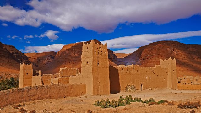
Tafilalet, Morocco
Jun 28, 2022

Cittadella, Gozo, Malta
Jun 28, 2021


Montreux and Lake Geneva in Switzerland
Jun 28, 2019


A boardwalk in Norddorf on Amrum Island, Germany
Jun 28, 2017
