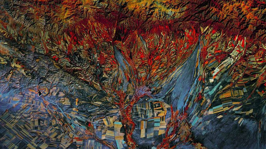
Landsat 8 satellite’s infrared photo of fields in Kazakhstan
© NASA
Landsat 8 satellite’s infrared photo of fields in Kazakhstan
The Landsat Earth-imaging program is jointly managed by NASA and the US Geological Survey. Its mission is to capture a continuous visual record of the Earth’s surface, and it’s been doing this for longer than any similar endeavour. The first Landsat craft, known as the Earth Resources Technology Satellite, launched in 1972. Landsat 8 launched in 2013, and continues to orbit the Earth, taking photos such as this composite image of Kazakhstan’s topography. This photo combines infrared imaging with a more traditional full-spectrum photo. And because of its quilt-like appearance—as if Picasso had made quilts—this image is included in the Landsat ‘Earth as Art’ collection of photos from the satellite.
Related Images
Bing Today Images

Tre Cime di Lavaredo, Italy
Dec 11, 2024

Winter in Huangshan Mountains, China
Dec 11, 2023

Roßstein and Buchstein, Bavaria, Germany
Dec 11, 2022

Mount Everest's shadow over the Himalayas, Nepal
Dec 11, 2021

Poinsettia leaf close-up
Dec 11, 2020

 Tea garden at Yangjiatang Village, Songyang County, China
 Aerial view of Sydney Harbour, New South Wales, Australia
 Prioro, Castile and León, Spain
 Half-timbered Houses of Freudenberg, North Rhine-Westphalia, Germany
 Temple of Hathor, Dendera Temple Complex, Qena, Egypt
 Aerial view of Bora Bora in French Polynesia
 Grand Canal and the Basilica di Santa Maria della Salute, Venice, Italy
 Italica, an old Roman city in Santiponce, Sevilla, Andalusia, Spain