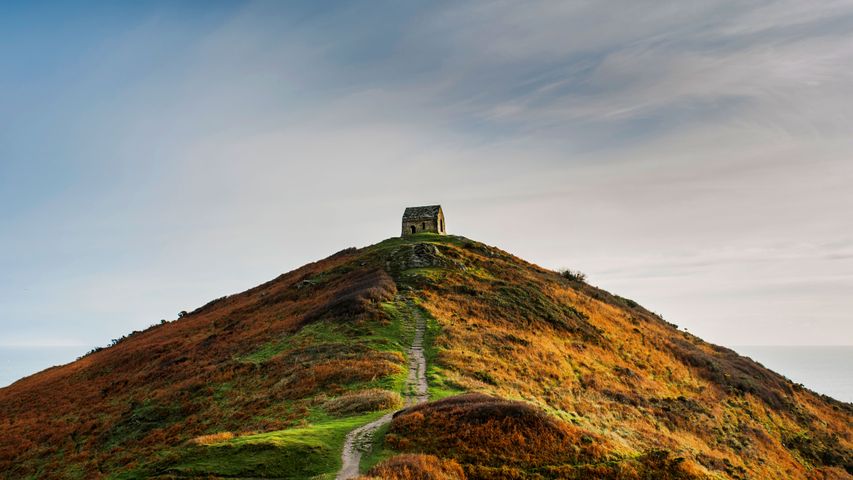
Low angle view of Rame Head, Cornwall.
© Cavan Images/Offse
Taking the high ground
This lonely little chapel has looked out from the top of Rame (or Ram) Head, a coastal headland in south-east Cornwall, for hundreds of years. Dedicated to St Michael, its earliest records date back to 1397 when it was first licensed for Mass. Since then it’s had many roles, including warning sailors off treacherous rocks and raising the alarm about enemies approaching by sea. It served as a navigational aid for centuries and even gets a mention in a sea shanty. By the early 20th century, the chapel had fallen into ruin but it got a new lease of life during World War Two, as a radar station looking out for low-flying enemy aircraft. A concrete platform remains on the other side of this ruined Grade II-listed chapel, a reminder of its war service.
With panoramic views along Whitsand Bay to the west and Plymouth Sound to the east, not to mention the remains of an Iron Age fort dating back 2,500 years, there are numerous reasons to hike up to the top of the headland here, part of the 630-mile long South West Coast path. The wider peninsula is also a home to the picturesque villages of Kingsand and Cawsand - once popular smugglers’ haunts - dramatic cliffs, sandy beaches and the 800-acre Mount Edgcumbe park, a Grade I-listed landscape.
Related Images
Bing Today Images


 Cinque Torri, Dolomites, Italy
 Chisos Mountains, Big Bend National Park, Texas, United States
 Little Pigeon River, Great Smoky Mountains National Park, Tennessee, United States
 Zion National Park, Utah, United States
 Gaztelugatxe islet, Basque Country, Spain
 Marine iguanas, Galápagos Islands, Ecuador
 Ad-Deir, Petra, Jordan
 Double Arch seen through Cove Arch, Arches National Park, Utah, USA

